

The Munros
The Best (in our opinion)
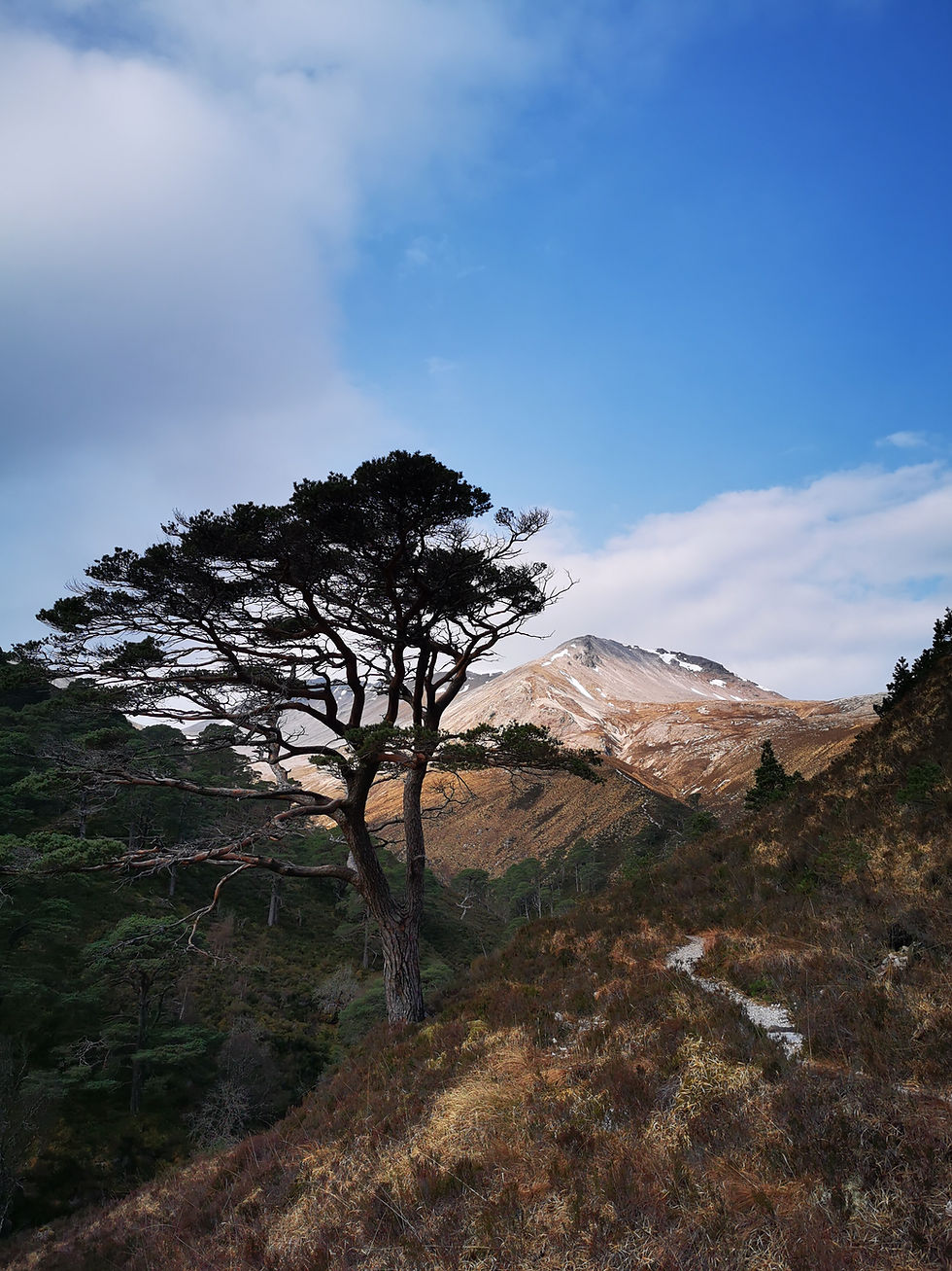
The Munros
When Sir Hugh Munro first published his Munros Table in 1891, little could he have guessed that completing the Munros would take off as a phenomenon.
The Munros are mountains in Scotland over 3,000ft (or less romantically, 914m) and there are currently 282.
The 3,000ft rule is pretty much the only criteria. This causes a few problems when you get subsidiary summits of 3,000ft or above that are too close to the highest point or not enough descent / re-ascent between them for them to be considered separate Munros (rather they are called Munro tops, but are not included as Munros).
As for what constitutes enough distance or descent / re-ascent is purely subjective, undefined and the decision sits now with the Scottish Mountaineering Club.
However, challenging yourself to complete the Munros will take you on adventures you wouldn't believe and to some of the remotest parts of the Scottish Highlands. I often get asked what my favourite Munro is. And it's a difficult one to answer. It depends on who I'm with, what season it is and what the weather is doing. One mountain can be benign with stunning views on one day or an epic scare fest depending. They are all magnificent in their own way.
Below I've listed some of the best days out on the Munros. I am perfectly happy to do these circuits as a private guide or indeed, any of the Munros. Some (such as Liathach in winter or the Aonach Eagach) I will bring someone in who specialises more with ropework - MCI/WMCIs. You can hover over the map for a quick index by region.
Just get in touch if interested - but hopefully these will provide some inspiration!

North
& South Cairngorms
North & South Cairngorms Includes:
Central
& South

Central & South

If you're interested in this walk or this area:
The Mammores
Level 4 walk - Long and Hard Mountain Day
Another cracking day out on the Munros. The Mammores. Binnein Beag, Binnein Mor, Sgurr Eilde Mor and Na Gruagaichean. These can be accessed via a long walk past the Steall Hut from the end of Glen Nevis, or from Kinlochleven. Perhaps less dramatic than the Ring of Steall, tackling these hills from Glen Nevis gives a wonderful feeling of being remote.
I've been to these on a classic near blue sky winters day from the longer Steall Hut approach. Over night we'd been given the spectacular display of the Milky Way in stunning clarity. I've not been here for a number of years but I've heard the paths have been improved. That said despite being well frozen, we had a number of streams to cross involving the run, jump and hope approach!
Binnein Beag, despite it's smaller status to It's larger neighbours is a stunning pyramid mountain as seen from the top left picture. When covered in a blanket of snow with a blue sky behind it, it is absolutely spellbinding.
These can be approached from Kinlochleven or Glen Nevis.
Distance: Varies depending on which mountains are included and start point.

If you're interested in this walk or this area:
Glencoe - Buachaille Etive Mor
Level 3 walk - Moderate Mountain Day
Buachaille Etive Mor (or Buachaille Èite Mòr in Scottish Gaelic) means The Herdsman of Etive.
It guards the entrances to both Glen Etive and Glencoe and is one of the most imposing mountains on the main west coast trunk road between Glasgow and Fort William (the other arguably being being Beinn an Dotaidh with sweeping slopes and a railway on it's flanks near Bridge of Orchy).
Known to climbers as simply 'The Buachaille', it captivates visitors and photographers alike. It's near perfect pyramid shape as seen from from Rannoch Moor evokes in many the ideal of 'the perfect mountain' .
There are two Munros on the Buachaille, and you are actually looking at Stob Dearg (1021m). Stob na Bròige is at the other end of the ridge at 956m. In between them along this twisting ridge are two subsidiary tops.
The "usual" walkers route goes straight through two spurs as seen on the top right picture. In winter this can be an avalanche trap and has claimed many lives over the years. In summer, the good but steep track can be daunting...
But it's a great mountain. It's always been a privilidge to guide on it. For many, climbing Buachaille Etive Mor has been a lifelong dream given it's fame and prominence.
Like all of the Glencoe mountains, it's steep and rocky, but the ridge itself is for the most part wide and undulating. Once on Stob Dearg, the whole panorama of Rannoch Moor opens up. Stob na Bròige shows off the whole of the Glen Etive range and out to sea.
To see the approximate start point in Google Maps, please see here (opens in a new tab).
Distance: 11km; Ascent: 1,000m; Approx time: 6-8h

If you're interested in this walk or this area:
Glencoe - Aonach Eagach
Level 3 walk - Moderate Mountain Day with Scrambling
There are a few Munros that terrify the new Munro bagger. The InPin on Skye perhaps, the idea of bothying to reach some of the remoter ones, and usually the Aonach Eagach....
The Aonach Eagach (Notched Ridge) however is a spectacular day out. It's been described as "Crib Goch on steroids". It's 4 times the length for the scrambling section and famous for being knife edge with no escape routes.
This is one to do if you are with someone with scrambling experience or a suitably qualified guide if even remotely unsure. And no shame in it.
The usual route starts near the top of Glencoe up to Am Bodach (a top) and along to the first Munro Meall Dearg. And here is the tricky bit, a slimy scramble down to the ridge. This is daunting in the mist and potentially lethal when wet. But ropes can be used.
Weirdly, there are old fence posts along the first section boundary marking. As if the knife edge ridge wasn't good enough. But a path snakes along the top and then the scrambles begin. And the fun continues for 2km until you reach the second Munro Sgorr nam Fiannaidh. It is a wonderful ridge. Grade 2 in summer, I/II in winter.
To see the approximate start point in Google Maps, please see here (opens in a new tab).
Distance: 6km; Ascent: 914m; Approx time: 5-7h

If you're interested in this walk or this area:
Glencoe - Ballachulish Horseshoe
Level 3 walk - Moderate Mountain Day
The Ballachulish Horshoe looks over the bridge separating north and south Ballachulish. They are imposing hills made up of several tops and the two Munros Sgorr Dhearg and Sgorr Dhonuill.
I've been arround these a number of times now in summer/winter and via various means. The first attempt I made ended up in retreat as the forestry had razored the entire plantation to an impassable massive collapsed jenga.
But since exploring a bit more, I discovered going up Schoolhouse ridge. It's a grade I scramble in both summer and winter conditions.
This takes you up to one of the tops (Sgorr Bhan) where you are met with the dramatic and aesthetically appealing ridge line up to Sgorr Dhearg. This ridge line sweeps spectacularly around and up to the main summit.
IMHO it's the finest ridge line in Scotland. Not technical, just beautiful in near perfection.
The horseshoe gives great views across Glencoe, down to Loch Leven, Ben Nevis and beyond on a clear day.
It's a nice variation avoiding as much of the forestry commission area as you can (still haunted by that!). The "usual descent" is to head back to the col and be met with a very steep and loose track down to the plantation. Instead you can carry on along the ridge and drop down around the 800m mark to avoid as much of the plantation as possible.
To see the approximate start point in Google Maps, please see here (opens in a new tab).
Distance: 16km; Ascent: 1210m; Approx time: 5-8h

If you're interested in this walk or this area:
Glencoe - Bidean nam Bian / Lost Valley
Level 4 walk - Long and Hard Mountain Day
Glencoe. It's a very popular and scenic place. Often heaving. But it is understandable why. It is dramatic, breathtaking and the main A82 between Glasgow and Fort William runs through it. The mighty Buachaille Etive Mor stands as a sentinal, guarding the head of the Glen and is a classic pyramid mountain which is perhaps one of the most photographed mountains in Britain.
There are so many classic routes here - rock climbs, winter climbs, scrambles, walks. But perhaps two really stand out. The Aonach Eagach (will visit another time) and a tour of Bidean nam Bian and Stob Coire Sgreamhach via Stob Coire nan Lochan (often referred to as SCNL) and the Lost Valley (Stob = point in gaelic). Bidean nam Bian is the highest point in the area until you get to Ben Nevis. And it's hidden from the road behind the towering three sisters of Glencoe and the spiky summit of SCNL - a former Munro demoted to the status of a Munro top for being too close/not enough drop/reascent between it and Bidean nam Bian.
The path to SCNL has been improved over the years. But it's a very steep climb to get up to the Coire bowl. There can be snow even in summer in some of the gulleys and this amphitheatre is a regular winter skills venue. From here, the paths fade somewhat and you can take the left or right spur up to the summit of SCNL with commanding views over the whole Aonach Eagach. The narrow ridge between here and Bidean nam Bian is straight forward, but a short scramble takes you to the summit of Bidean itself with spectacular views to the Glen Etive Munros and Loch Etive.
A good track descends steeply along the main ridge to Stob Coire Sgreamhach. A return to the col gives you a glimpse at the descent down to the Lost Valley. "Seriously!?" it's very steep and eroded. But you soon join a good stepped track down to the almost tranquil flat of the lost valley. However, a wooded final descent and a stream crossing add to make this a diverse and challenging day out. But hugely rewarding!
To see the approximate start point in Google Maps, please see here (opens in a new tab).
Distance: 12km; Ascent: 1090m; Approx time: 7-8h

If you're interested in this walk or this area:
Schiehallion
Level 2 walk - Longer, easy hill walk
A lovely day out on the Munros is Schiehallion (assuming the weather plays along).
This Munro is set apart from the rest in the central Highlands and is visible for absolutely miles around. On the flip side this also means the views are absolutely extensive on a clear day.
This isolated location but relatively easy access meant Schiehallion was chosen by Charles Mason in 1774 for a planned experiment to estimate the mass of the Earth. However, Mason turned down a commission to carry out the work and it fell to Nevil Maskelyne and Charles Hutton to undertake it. The result was surprisingly close as confirmed by later experiments.
During the surveying of Schiehallion, Charles Hutton, devised a graphical system to represent surveyed heights which later became known as contour lines.
There is a good car park though it can get busy. This is a popular hill. The path underwent extensive repairs a decade ago but there are still rocky sections. My first visit to Schiehallion was at night and in the pouring rain. The sort of rain that seems to generate a mist of smaller rain as It's falling so hard. Head torches simply reflected light almost like full beam headlamps in dense fog. But we made it and back again.
Another visit was on a crystal clear winter's day. The isolated location of Schiehallion also means it's gets the full effect of the wind, and the snow can get carved into great wind scoops, impressive sastrugi and other weird rime ice sculptures...
It's a great and popular day out.
To see the approximate start point in Google Maps, please see here (opens in a new tab).
Distance: 8km; Ascent: 753m; Approx time: 3-5h

If you're interested in this walk or this area:
Glen Lyon 4
Level 3 walk - Moderate Mountain Day
The circuit of the four Glen Lyon Munros is a very satisfying day out - Carn Gorm, Meall Garbh, Carn Mairg and Creag Mhor. There is a good track to begin with and a mountain path around aided by old fence posts that are useful in poor visibility.
These four Munros on the north side of Glen Lyon lie on a mostly broad and undulating ridge.
I've been around this circuit a few times and backed off in high winds once. However, for a great and long day out on a good day this place is amazing. In my opinion, a finer day out than the classic Lawers ridge. Here, you get more of the remote feeling. It's a circular horseshoe with easier escape routes should you want to shorten the day and you don't need a two car faff as you end where you began.
The one tricky part is the descent off Carn Mairg as It's a bit bouldery requiring balance and good footwork. In winter, the rime ice makes some wonderful sculptured coats on the fence posts.
But on the whole, It's a day for just being out there enjoying fresh mountain air and having a great long walk.
With excellent views over the glen to the Lawers range, and over Loch Rannoch, it's basically a really nice and mentally untaxing day when the weather is good. And you still feel you've earnt a nice meal out in Aberfeldy
These pics were from November 2017 when I headed out by myself for a few days and had some great weather. And yes that's Fabian in one of them.
To see the approximate start point in Google Maps, please see here (opens in a new tab).
Distance: 18km; Ascent: 1,390m; Approx time: 7-8h

If you're interested in this walk or this area:
Ben Chonzie
Level 2 walk - Longer, easy hill walk
Ben Chonzie has been described as the most boring Munro in various guidebooks. Well it's true there is nothing technical about it and there is a ruddy great track all the way up it.
It's not particularly steep and it's a bit of an L-shaped wide ridge.
I have very little memories of the first time I climbed this one. Perhaps it was just a typical Scottish summer day (wet and grey). But on the same few days I revisited Glen Lyon I arrived mid afternoon from York and decided to have a bit of night nav practice. Not that I really got the chance to practice much. Higher up if there was a path it was buried under snow.
The drive along the small track to the usual parking place was probably the most technical as it was coated in black ice patches. But others had made it and there were a few cars parked up and folks returning as I pulled up. I got a few strange looks from people returning seeing this lonesome chap starting to head up the mountain in the fading light. But I had a brilliant evening. Not much cloud, the moon making an appearance and being treated to a pink - orange and purple light display in the sky and rebounding off the surround snow-capped hills.
The wind was pretty howling though. I made it down to the level track before needing to turn the head torch on and by the last km it was properly dark. I think it took me 3-4h in total.
So if someone says a hill is boring, change the picture a bit as I did. I still remember this "boring" hill as a great evening out!
To see the approximate start point in Google Maps, please see here (opens in a new tab).
Distance: 14km; Ascent: 670m; Approx time: 3-5h

If you're interested in this walk or this area:
Ben More & Stob Binnein
Level 2 walk - Longer, easy hill walk
Ben More near Crianlarich at 1,174m is the largest mountain in the southern Highlands by some way. There is nothing higher in Britain to the south. It is the largest hill in the Trossachs. There are 7 Munros in this particular cluster which are normally tackled in pairs from Crianlarich leaving the last one for a more south westerly approach.
They can all be done in a very long and challenging day.
Ben More is also an accessible hill. The "normal" route heads up from just past the small village but major crossroads which is Crianlarich. It's on the main A85 linking east-west as well as just off the main west coast trunk road A82. There's even a train station. It's not relatively far north of Glasgow.
This route takes you to the col (lowest point) between Ben Mord and Stob Binnein - another colossus at 1,165. While here it is sensible to bag both Munros.
However there is a quieter approach from the south (the Balquhidder approach) which is far more satisfying. It gives tremendous views across to the Stirling Ben Vorlich and Stuic a'Chroin Munros as well as having a decent track which heads straight up to Stob Binnein. From here it's down to the col and up Ben More, then back over Binnein. If you're up early enough you may get a spectacular sunrise. Soon after the sunrise on this particular day we were treated to more typical October weather which didn't lend itself to photography!
So It's a couple of hundred meters more ascent but thoroughly worth it.
To see the approximate start point in Google Maps, please see here (opens in a new tab).
Distance: 13km; Ascent: 1,800m; Approx time: 5-7h

Ben Vorlich (Arrochars)
Level 3 walk - Moderate Mountain Day
Despite the evocative sounding name "Arrochar Alps", these are really accessible being some of the most southerly Munros and the first you encounter on the A82. They border the mighty Loch Lomond not far north of Glasgow.
Getting there by train is straight forward enough. By boat (probably) and by car is terrifying as the A82 is wiggly, narrow and has coaches/lorries/caravans coming at both directions.
That aside there is a big car park and tea room in Inveruglas. A good track leads you up toward Loch Sloy, a Reservoir driving the large Sloy hydro powerstation which you walk past.
A small cairn marks the turn off for the "usual" track. From my last visit it's a badly eroded motorway path. But there are many other less common approaches that you can take and I avoid the eroded bits and vary routes.
It is steep though. The Arrochars are rocky beasts. There are 4 Munros here but it's the Cobbler (a Corbett) which has bite - a complex top with scrambley summits requiring some climbing tools in winter.
Ben Vorlich is perhaps the most sedate from this side. You can follow the motorway or find a less used route up and weave your way around outcrops. Eventually you reach the summit plateau. It's a short ridge with a trig point at one end and the true summit further along and a few metres higher.
The views on a good day take you across to the other fine peaks of the Arrochar, up to the Crianlarich 7 with Ben More dominating, Ben Lomond and the whole of Loch Lomond.
On a grey day it's a nice outing nevertheless as it's not too taxing to follow a path. But these pics are from late winter 2016 when we were rewarded with a spectacular cloud inversion.
To see the approximate start point in Google Maps, please see here (opens in a new tab).
Distance: 10km; Ascent: 900m; Approx time: 4-6h
If you're interested in this walk or this area:

North & South Cairngorms

If you're interested in this walk or this area:
Cairn Gorm, Ben MacDui & Beinn Mheidhoin
Level 4 walk - Long and Hard Mountain Day
Well, few come better than a round of Cairn Gorm and Ben MacDui. Add in a detour to Loch Etchachan and Beinn Mheidhoin and you've one epic day out.
Unlike the west coast Munros, the Cairngorms (Am Monadh Ruadh or the red mountains) are just huge, vast and for the most part rounded. The highest, windiest and coldest part of Britain.
Ben MacDui is the second highest point on the island of Britain at 1,309m (4,295ft) and five of the ten 4,000+ footers are in the cairngorms.
It's hard to choose any one day out here which isn't magnificent. The Braeriach-Devil's Point walk is amazing. Derry Lodge is a great and stunning place to start any number of days out, and the southern Cairngorms (south of Braemar/Ballater) hold their own magic...
To see the approximate start point in Google Maps, please see here (opens in a new tab).
Distance: 22.5km; Ascent: 1,500m; Approx time:8-10h


White Mounth (Lochnagar Circuit)
Level 4 walk - Long and Hard Mountain Day
Another brilliant day out on the Munros is the White Mounth circuit from Loch Muick.
This is a long walk (ca 18 miles) taking in 5 Munros: Lochnagar, Carn an t-Sagairt Mor, Carn a’Choire Bhoidheach, Cairn Bannoch and Broad Cairn
However it is quite straight forward once you are up on Lochnagar. You are basically wandering around a large undulating plateau with magnificent views to the northern Cairngorms on a fine day. It offers a majestic high level walks with vast panoramas around you. The sheer feeling of space is exhilarating.
The main interest is Lochnagar with it's wonderful amphitheatre - scene to rock climbing and winter climbing. There are good paths all around the area and you will often see big family/friends groups out and about so it can be a social day too.
However in the mist it needs careful navigation as it is quite a featureless plateau. It's the views this walk offers which is the highlight so definitely one for spring or a good day. Indeed, given the rather woolley definition of a Munro, It's surprising there are 5 Munros on this route whereas somewhere like the 5 sisters of Kintail only have three.
In spring and autumn you can be rewarded with some amazing cloud cascades. Literally running like a gaseous waterfall down some of the slopes.
To see the approximate start point in Google Maps, please see here (opens in a new tab).
Distance: 22.5km; Ascent: 1,500m; Approx time:8-10h
If you're interested in this walk or this area:


Beinn a'Ghlo
Level 3 walk - Moderate Mountain Day
Made up of 3 Munros: Càrn Liath, Bràigh Coire Chruinn-Bhalgain and Càrn nan Gobhar.
Usually tackled from around Blair Atholl, this is a brilliant day out on a wide undulating ridge. I've done this circuit as part of a memorable 3-day wild winter camping epic, and also as a single winter walk. And I've done the route in both directions.
Heading along the Glen past the mountains gives you the chance to traverse the ridge roughly west to east so that you get the setting sun on the return which as you'll see in the second picture, was timed perfectly!
To see the approximate start point in Google Maps, please see here (opens in a new tab).
Distance: 22km; Ascent: 1,250m; Approx time: 6-8h
If you're interested in this walk or this area:
North West Highlands

If you're interested in this walk or this area:
Beinn Dearg Range
Level 3 walk - Moderate Mountain Day
A cracking day out on the Munros takes us to near the lovely village (or town?) of Ullapool. It's north of the Fisherfields at the head of Loch Broom in the Inverlael area. The Beinn Dearg Range.
Most of us visiting will travel up via Inverness. The A9 gets left behind and we travel from East to West Coast. The road heads up past the massive whaleback of Ben Wyvis and up into a high plateau. Ahead lies the Fannaichs and Beinn Dearg range.
Beinn Dearg (there are quite a few Beinn Deargs) is most frequently climbed by following the River Lael up Gleann na Sguaib. Starting from near the head of Loch Broom, a path follows the glen to a wide bealach (col or saddle).
It's a nice track, passing first through farmland, woodland, open moorland and up onto this rocky plateau. There is a rather helpful dry stone wall which you can handrail almost to the summit of Beinn Dearg.
From the bealach, the neighbouring peaks of Con a' Mheall and Meall na Ceapraichean can also be bagged with relative ease as the distances and reascent isn't actually that much. If you have time, you can add Eididh nan Clach Geala, which lies about 3 km north of Beinn Dearg along the ridge giving you 4 Munros.
The views are impressive. You can see Con a' Meall from the road as the cliffs drop spectacularly beyonf the summit to the north. You can also see the Skye mountains on a clear day and even the northerly four Munros. The Fannaichs and An Teallach to the south...
These hills mark a boundary between what most in Britain consider is a normal landscape and something that is completely far out. Heading further north from Ullapool opens up a landscape which seemingly shouldn't exist in tidy Britain. It is wild. Hills rise almost out of nowhere and stand isolated. There are huge steps which have risen out of the folding of the Earth. It is a strange and amazing place. Sutherland.
To see the approximate start point in Google Maps, please see here (opens in a new tab).
Distance: 24km; Ascent: 1,520m; Approx time: 7-11h


The Fisherfields
Level 5 walk - Long and Hard Wilderness Mountain Days
The Fisherfields are in a breathtaking location near the coast between Gairloch and Ullapool. There are two dramatic Corbetts standing like sentinels (Beinn Dearg Beag and Beinn Dearg Mor), 5 Munros and all the while the notched ridge of An Teallach guards one of the entrances.
There used to be 6 Munros, but
Beinn a'Chlaidheimh was demoted a few years back for being a couple of cm below 3,000ft. However, this is a great one to add to the traditional round. The steep sides greet you as you come in!
Whether you are aiming for the Fisherfields 5 or 6, these hills can be done in chunks over 2 separate days with very long bike-in. But it's a place to enjoy. To experience and for many on their Munro round, experience wild camping.
But it is truly a place where conditions and weather dominate. There are two river crossings that can be anything from a trickle to a wide raging torrent and the worst swamp in Scotland. Paths are generally good where they exist but the rivers are unavoidable if staying here. I've been there in May in full on winter conditions, had water poisoning, ended up waist deep and alone in the swamp, had baking heat for 3 days and had my tent flooded with resultant hypothermia. It is a wild place. Expect the unexpected.
Sheneval Bothy is the go to place. But even a packed bothy empties as folks drift off on their routes. Suddenly It's just you and your companions. The Munros are alleged to have the best views in Britain. Perhaps because of the effort of getting there. But you decide. It is a place of panoramas when clear. Epic sunsets and escape from reality for a few days.
To see the approximate start point in Google Maps, please see here (opens in a new tab).
If you're interested in this walk or this area:
I also run this specific trip each year and you can find out more on the Weekend Adventures Page

If you're interested in this walk or this area:
The Fannaichs
Level 3 walk - Moderate Mountain Days
This range consists of 9 Munros. They can be tackled over a series of walks or even in a day for the enthusiastic.
This whole area is just spectacular. You start on the high plateau between Inverness and Ullapool around Braemore Junction - the split for the Fisherfields and Beinn Dearg range.
Up here you get the views to Torridon, Beinn Dearg, An Teallach in it's spectacular razor-notched glory and up to the far north.
The terrain through the main Glen follows good tracks for the most part and there are paths through most of the bouldery bits. But a lot of the area has an other worldly wild quality that is almost pioneering about it.
There is magic up here when the weather plays along. Wispy clouds, localised mysterious fog patches. It's my first suggestion to clients as an alternative when the Fisherfields are too wet.
Sgurr Mor is a stunning mountain. Elegant. At 1,110m this is the highest point in this range. Most of the others are all hovering just below the 1,000m mark. Neighbouring Beinn Liath Mor Fannaich (my 200th Munro on my first round) gives the best views of it. Accessible yet remote, dramatic yet doable in a (very long) day, sweeping ridge lines, squelchy ground, good paths, boulders. It has a bit of everything...
To see the approximate start point in Google Maps, please see here (opens in a new tab).

If you're interested in this walk or this area:
Liathach
Level 4 walk - Hard and Long Mountain Day
There are a few epic ridges on the mainland of Scotland. And this is one of them.
Everything is eerie and mysterious about it. Torridonian Sandstone is ancient. Among the most ancient rock groups in Britain. And it makes it's own laws. Even the widespread lichen Rhizocarpon geographicum - easily spotted by it's bright green and black spotted thallus is turned purple here.
When you first see it from the winding single track road between Kinlochewe and Torridon, it captures the eye. A wall. A fortress. Impenetrable. How do you even get there??
Well there are faint paths leading up. A few weaknesses in the mighty armour. Once up, there are two Munros:
Spidean a' Choire Lèith at the east of the main ridge, and Mullach an Rathain to the west.
And between them - even before you get to the first one on the usual east-west traverse, there are knife edge ridges, pinnacles and steep drops. A bypass track largely misses out the pinnacles but in places even this is not for the faint hearted.
But once you've made it to the ridge, it is a wonderful day to just explore, experience, see and touch. In summer this is a dramatic but relatively short day out. Although graded as a Grade II winter route, Liathach refuses to be held to any rule and it can be as variable as it chooses to be.
The Torridon giants are ancient!
To see the approximate start point in Google Maps, please see here (opens in a new tab).
Distance: 11km; Ascent: 1,310m; Approx time: 7-8h

If you're interested in this walk or this area:
Sgorr Ruadh & Beinn Liath Mor
Level 3 walk - Moderate Mountain Day
Beinn Liath Mor and Sgorr Ruadh from Glen Carron. These two Munros have the Corbett Fuar Tholl you can add. But the Munros themselves are spectacularly diverse both in vegetation and rock type with their own challenges which by themselves gives a truly rewarding and full day out.
Sgorr Ruadh approach takes you through a maze of lumps, bumps and squelchy ground. Descending to the first col involves a few steep and rough sections and then a scramble up to get around a lump which separates these two magnificent mountains.
Beinn Liath Mhor is absolutely sublime. It glows in the right light. A wonderful undulating ridge takes you back with two further lower summits. On a good day you have the entire panorama of the Torridon giants that dominate the views North - Beinn Alligin, Liathach and Beinn Eighe.
What's even better is you can get the train directly to Achnashellach Station where the walk starts.
To see the approximate start point in Google Maps, please see here (opens in a new tab).
Distance: 14km; Ascent: 1,140m; Approx time: 7-8h

If you're interested in this walk or this area:
North Glen Affric (South Loch Mullardoch)
Level 4 walk - Long and Hard Mountain Day
Level 5 (if wild camping) - Hard and Long Wilderness Mountain Days
The North Glen Affric Munros (some pics taken from Loch Mullardoch).
8 spectacular Munros make up this ridge. They are big, remote, and wild.
Glen Affric itself is perhaps one of my favourite Glens. Scots pine forest dominates the entrance. It is like travelling back to an earlier age. Cars have to park up at the entrance. It is a huge and long glen. Spiky Munros dominate both sides.
Right in the middle is a remote youth hostel which is most easily accessed from Glen Shiel via a 3-4h walk. And you need to bring everything with you.
This Glen captivates me. Glen Affric is somewhere that could have been used as a Lord of the Rings set. It is diverse in flora and fauna, ancient woodland giving way to Heather moorland and rocky summits. And it really is remote and huge. Walks here require a bike if you want to get in and out to the more central ones in a day. But why rush it? Spend some time here to explore.
I was lucky enough to be with a University club for a week staying in Strawberry Cottage and a year later, at one of the Edinburgh Uni bothy at the other end so I got to see the place in it's entirety. It is here that I did my wildest winter exped ever.
This Glen is packed with Munros. Some blow you away with their shapes and size, others are hidden gems. This is a place of mystery, tales and legends. Stories and epics. A place of tranquil beauty and howling storms.
To see the approximate start point in Google Maps, please see here (opens in a new tab).
North Glen Affric can be explored via a series of day walks or a wild camp.

If you're interested in this walk or this area:
North Glen Shiel (South Glen Affric)
Level 4 walk - Long and Hard Mountain Day
Glen Shiel. This is akin to Glencoe in many respects. But far less busy. The road to the Isles (Skye) runs through it. And it is huge. It's an "all or nothing" place. There aren't any short mountain days here.
To the North are the famous 5 sisters of Kintail, the 4 brothers, 3 cousins etc. One Munro top - sgurr na Spainteach was named after the Spanish following the battle of Glenshiel when Spanish troops fought in the Jacobite rising.
This north Shiel ridge makes up the South Glen Affric mountains as to the north are a succession of Glen's lined up in near parallel.
There are tracks and the Munros to the east are far easier than the Western edge. But the North Shiel ridge / South Affric ridge is epic. With plenty of scrambling and some hair raising knife edge ridges. Perhaps the only Munro which is a single Munro day walk is the epic Ciste Dubh, a stunning needle point summit with a dramatic ascent. It rewards you with spectacular views of Glen Shiel North ridge Munros and down into Glen Affric and beyond.
And there are mountains in every direction. It is an exciting place. It is a Munro baggers dream with 22 Munros on offer! And I love it
To see where Glen Shiel is in Google Maps, please see here (opens in a new tab).
North Glen Shiel can be explored via a series of day walks

If you're interested in this walk or this area:
South Glen Shiel Ridge / Forcan Ridge
Level 4 walk - Long and Hard Mountain Day
The Glen Shiel 7 boasts 7 Munros as the name suggests with terrific views across to the North Shiel ridge and across to the Knoydart Hills to the south.
The ridge is long. Roughly 13 km. The bonus being that each Munro isn't separated by enormous cols. The ridge doesn't drop below 800m and the highest summit is just a bit over 1,000m. It's still a long day however as you follow the track undulating and snaking around. It is typically done from near the Clunie Inn near the top of the Glen and finishes further down. The reasoning being that you start higher up meaning less ascent overall.
It is a magical day. A long and tough day but bar a few short scrambles (one unhelpfully at the end in descent) it is straight forward. It gives you that full day out experience with the satisfaction that your Munro tally has gone up by a whopping 7!! Separately, there is the saddle and Sgurr na Sgine. A brilliant circuit of 2 Munros with the infamous Forcan Ridge (grade I or III scramble). The scrambles can be missed out but that does seem almost criminal.
This Glen is a Munro baggers paradise, steeped in history and in an area packed with mountains with views across to Skye on a fine day. It really doesn't get much better.
To see where Glen Shiel is in Google Maps, please see here (opens in a new tab).
South Glen Shiel Ridge Distance: 24km; Ascent: 1,829m; Approx time: 7-11h
Forcan Ridge Munros Distance: 16km; Ascent: 1,430m; Approx time: 5-7h